Air Quality Modeling
Wintertime ozone concentrations exceeding EPA standards have been known to science for about a decade, and many aspects of winter ozone pollution are still poorly understood. Meteorological and chemical models that researchers and regulators use to simulate air quality were designed for summertime urban conditions and struggle to accurately simulate the winter ozone episodes of rural oil and gas producing areas like the Uintah Basin. EPA requires that these computer models be used in the development of regulations to control air pollution, and the more accurate models are, the more reliable they will be for development of effective and cost effective solutions to wintertime air quality problems.
In partnership with federal and state agencies and other academic institutions in the state, the Bingham Center is developing a modeling framework that is specific to the wintertime inversion episodes in northeastern Utah. This framework utilizes the Weather Research and Forecasting (WRF) model, the Sparse Matrix Operator Kernel Emissions (SMOKE) model, the Comprehensive Air Quality Model with Extensions (CAMx), and the Community Multiscale Air Quality Model (CMAQ). The Bingham Center is working in several areas to improve these models.
The WRF meteorological model is unable to adequately simulate the unique meteorological conditions that exist during multi-day winter inversions in the Uintah Basin. Inversions in the Basin are much stronger even than those that occur along the Wasatch Front, and WRF, which was not designed with mountain-valley inversions in mind, routinely overestimates wind speeds and the level of intrusion of clean air from outside the Basin. We are developing new model configurations and comparing model outputs to measurements to improve and verify these simulations.
 The chemical mechanism software utilized by CAMx and CMAQ was developed for summertime, urban conditions and in many cases does not take into account the temperature dependence of chemical reactions important to ozone production. We are incorprating temperature dependence and adding reactions, such as those involving methane, that are more relevant in the oil and gas-producing Uintah Basin than in conditions for which the models were designed.
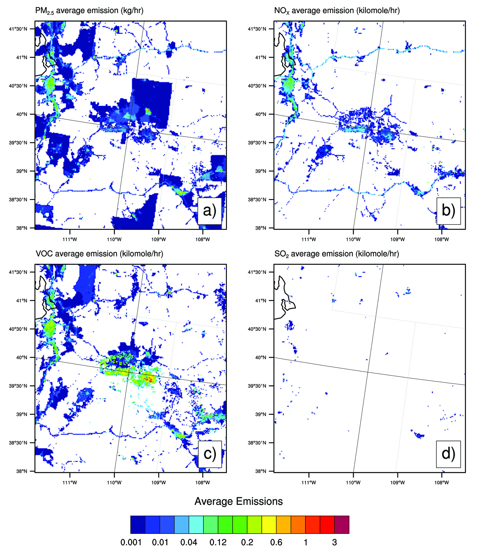
Several different inventories exist of emissions in the Uintah Basin. These include the National Emissions Inventory (NEI), prepared by EPA using data supplied by the states, an oil and gas-specific inventory developed by the Western Regional Air Partnership, a private consortium working with an environmental consulting firm (Environ), an inventory developed for the Bureau of Land Management’s (BLM) Air Resources Management program by another consulting firm (AECOM), an inventory developed by the National Oceanic and Atmospheric Administration (NOAA) and University of Colorado researchers based on an aircraft flyover that occurred in February 2013, and a new 2014 inventory developed by a number of Utah air quality agencies, including the Utah Department of Environmental Quality. Each of these inventories results in different chemistry and different ozone levels in the Uintah Basin, and we are working to compare each with measurements of emissions and ambient ozone and precursors.