W.1.1 Irrigation system changes from 2018-2023
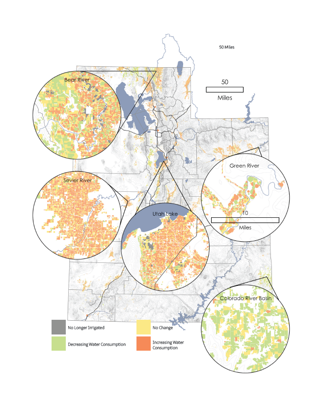
Made by comparing irrigation methods reported in 2018 and 2023, this map draws generalizations about changes in water consumption, or water lost to the natural system. System changes were grouped into three general categories using the Irrigation Conversion Water Savings Destination Calculator produced by Utah State University Extension: decreasing, increasing, and unchanging water consumption. Generally, non-irrigated lands are considered the least consumptive. Other watering systems, ordered from least to greatest consumptive, include drip systems, surface irrigation systems, and sprinkler irrigation systems.
W.1.2 Waterbody fill level at end of 2024 water year
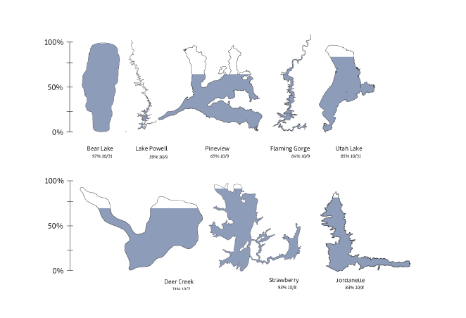
Made using reported reservoir storage information and lake elevation levels from the month of October, marking the end of the 2024 water year. This bar chart compares the elevation of several waterbodies. Footprints are colored to show the percentage of total capacity filled around peak season. The spatial size and total water volume is not represented here, instead the graphic shows the amount of water within each body with a normalized capacity.
Water conservation efforts have brought a host of policy and scientific attention to infrastructure efficiency. Across the state farmers are shifting irrigation methods to better align with known best practices, capitalize on incentives, and update aging infrastructure. Some of these changes are demonstrated in the map to the left.
The state of Utah has been in an off-and-on state of drought for the past several years. As weather patterns change, and we continue to exist in this natural drought cycle, it’s important to monitor and budget our water availability, storage, and use. The chart above highlights reservoir storage at the end of the water year for a few key reservoirs. High-storage volume is indicative of the past few years of good water. The following statewide water budget information provides further information about where we receive and use our water. This information is critical to understanding the complex natural systems that dictate our water availability and informing the political systems that govern it.
References
- Utah Geospatial Resource Center. (2024). Utah Water Related Land Use. (2018 and 2023). [Data set]. UGRC. https://gis.utah.gov/products/sgid/planning/water-related-land-use/
- Utah Division of Water Resources. (2024). Reservoir Conditions. [Data set]. Utah Department of Natural Resources. https://water.utah.gov/reservoirlevels/