Fluvial Fingerprints: Major New Database Tracks Sediment Across Mississippi River Basin
By Lael Gilbert |


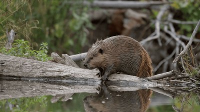
It’s long been known as the “Muddy Mississippi River” — but where does all that mud come from? Tracking the sources of excessive sediment in the Mississippi River Basin (MRB) has proven to be a vexing and economically important question for the last few decades, with impacts on water quality, fish populations, recreation and navigation.
Now, the first basin-wide sediment fingerprinting database makes it possible to track where sediment is coming from and how it moves through the entire basin, allowing managers and researchers to better understand water quality, measure the health of waterways, minimize erosion and identify sources of pollution. The new database standardized and consolidated multiple disparate, project-specific data into one publicly accessible map-based tool.
Sediment fingerprinting is a way to measure and identify sources of sediment in waterways. It defines unique physical and chemical tracers in sediment samples and matches them to specific locations upstream. Although smaller-scale efforts to track sediment in the MRB have been ongoing for decades, access and interpretation of the existing disparate data has been daunting. This new database compiles years of information from federal agencies, state programs and academic studies, and makes it available in a geospatial format in open-source tools.
The project is a collaborative effort between Patrick Belmont, Janice Brahney and Joseph Wheaton at Utah State University, the Natural Resources Conservation Service (NRCS) and the U.S. Geological Survey. With more than 225,000 samples and 3.7 million geochemical measurements, the resource can now be used for regional planning and model training, allowing managers to identify erosion sources and efficiently implement targeted solutions.
"It also offers a foundational resource for future research — improving monitoring efforts and guiding conservation strategies and planning," said Belmont, hydrologist in the Quinney College of Agriculture and Natural Resources and lead researcher on the project.
The work also includes an extensive review of prior sediment fingerprinting research projects, provides an assessment of methods used and insights gained across dozens of prior studies, and established guidelines for future data collection and consolidation.
In addition to the sediment fingerprinting database, the team developed a suite of new software tools to evaluate the different types of river channels throughout the nearly two million miles of streams and rivers that comprise the entire Mississippi River network. These tools were used to generate an interactive map that enables users to obtain an unprecedented amount of information about any part of the stream network in just a few clicks.
A powerful aspect of building “big data” software tools within projects like this is scaling up the analysis, according to the authors. Having this information about streams and rivers throughout the entire contiguous US can be a game changer for conservation managers and stream restoration practitioners.
“With the momentum built in this project, we were able to extend the availability of this information to the entire lower 48 states for 8.5 million miles of riverscape,” said Wheaton.
The USU researchers worked with the NRCS Conservation Effects Assessment Project to carry out the study and in coordination with the NRCS National Technical Training Center to ensure the new database and workflows align directly with the agency's Conservation Planning Process.
The project has already yielded important new perspectives on enduring questions: it had been assumed that most of the famous Mississippi Mud came directly off the extensive farm fields from the Upper Midwest, said Belmont — but they found that much of the sediment is actually erosion of the river channel banks themselves, which are eroding more aggressively due to increases in precipitation and extensive artificial drainage. The analysis also identified numerous locations that absorb more sediment than they produce, he said.
Access the new tools at the Riverscapes Data Exchange.
WRITER
Lael Gilbert
Public Relations Specialist
S.J. and Jessie E. Quinney College of Agriculture & Natural Resources
435-797-8455
lael.gilbert@usu.edu
CONTACT
Patrick Belmont
Professor
Watershed Sciences Department
435-797-3794
Patrick.belmont@usu.edu
SHARE
Comments and questions regarding this article may be directed to the contact person listed on this page.