
Summer 2026 Newsletter
The purpose of our mid-year newsletter is to inform stakeholders about our team's recent work and accomplishments. We produce an annual report in November of each year that comprehensively documents our research results, funding, and plans for the coming year. This newsletter provides a preview to the upcoming annual report and a less formal look at our team's goings-on. The purpose of all this is to get you involved in our work. If you have questions or suggestions, please reach out!
Table of Contents
Team News
New Employees

Arjun Kulathuvayal has joined the Bingham Research Center as a Research Scientist specializing in energy and materials science. He recently earned his PhD in Mechanical Engineering from the University of Oklahoma.

Megan Couture has joined the Bingham Research Center as a Student Administrative Assistant, helping with day-to-day tasks and keeping everything running smoothly. She is earning her degree in Elementary Education and is also training to be a Sport Pilot.

Ian Wilson has joined the Bingham Research Center as a Research Technician, where he assists with research and experiments.
Awards and Congratulations

Outstanding Student Researcher Award
Michael Davies was awarded the Outstanding Student Researcher Award, which recognizes a USU Uintah Basin student who has demonstrated excellence in original research, scholarly rigor, and meaningful contribution to their field. It honors students whose work reflects creativity, intellectual curiosity, and a commitment to advancing knowledge through collaboration with faculty mentors. The 2026 award was presented to Michael Davies for his work on winter ozone formation in the Uinta Basin and the development of BasinWX Roads, a computer vision system for road weather monitoring.

Goldwater Scholarship Award
Michael Davies was awarded the Goldwater Scholarship, one of the nation's most prestigious undergraduate awards in science, engineering, and mathematics.

Faculty Researcher of the Year
John Lawson received the Faculty Researcher of the Year award in recognition of his research contributions and ongoing work at the Bingham Research Center.

Best Undergraduate Student Presentation at NADP Spring 2026 Scientific Symposium
KarLee Zager recieved the award for the best undergraduate student presentation at the NADP Scientific Symposium in Madison, Wisconsin. Her presentation was about Organic Compound Fluxes at the Snow-Air Interface.
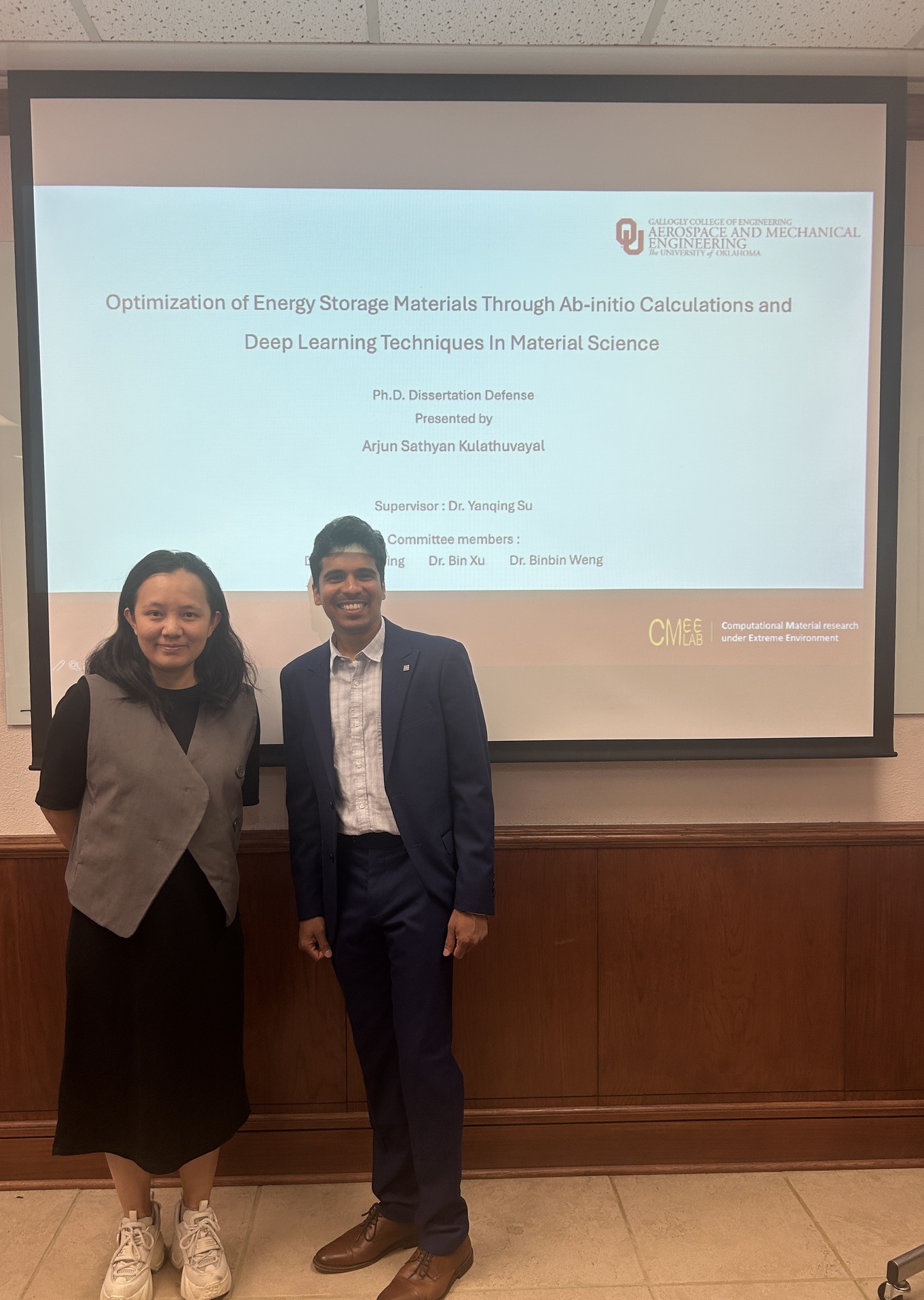
PhD Defense Completion
Arjun Kulathuvayal successfully completed his PhD dissertation defense, he now has his doctorate in Mechanical Engineering from University of Oklahoma.
Presentations
National Atmospheric Deposition Program's (NADP) 2026 Scientific Symposium
KarLee Zager and Seth Lyman attended the NADP 2026 Scientific Symposium on June 10-11, 2026, at the Madison Concourse Hotel in Madison, Wisconsin, and gave a 20-minute presentation during one of the symposium sessions.
Description of conference from the NADP website: https://nadp.slh.wisc.edu/nadp2026/
The 2026 symposium will focus on encouraging innovative approaches to air, deposition, and ecosystem monitoring and data analyses. The symposium will bring together scientists, environmental policy professionals, natural resource managers, and advocacy groups to advance the science and tools that are needed to effectively protect human and ecosystem health.

Authors: KarLee Zager, Seth Lyman
Co-authors: Trevor O'Neil, Brant Holmes, Kenzie Holmes, Tristan Coxson
Session Title: Aerosol Particles, Gases, and Air-Surface Exchange
Location: Madison Concourse Hotel, Madison, WI
Abstract:
Snowpack serves as a complex participant in atmospheric chemistry, acting as a reservoir, photochemical reactor, and potential source or sink for volatile organic compounds (VOCs). We hypothesized that VOC exchange at the snow-air interface varies by snow type and is influenced by environmental conditions, particularly ultraviolet (UV) exposure. To investigate these relationships, we developed a two-chamber cryogenic system capable of independently controlling temperature and UV exposure. Clean snow collected from a remote canyon location and dirty snow collected near active oil and gas development were exposed under controlled chamber conditions. Chamber bags were filled with ambient air, and VOC concentrations were quantified before and after exposure using gas canister GC-MS and DNPH cartridge HPLC methods. Approximately 70 VOCs were measured and subsequently grouped into hydrocarbon and oxygenated VOC families for analysis.
UV exposure produced the strongest and most consistent response across VOC families. Carbonyl and light alkene fluxes increased with increasing UV exposure, whereas alcohol responses remained comparatively weak. Snow type also influenced VOC exchange, although effects were generally smaller and less consistent than those associated with UV exposure. Dirty snow produced higher light alkene fluxes, while clean snow produced higher carbonyl fluxes.
Correlation analyses further revealed distinct environmental response patterns among VOC families. Alcohol fluxes were associated with ambient NOx and relative humidity and negatively related to ozone concentrations. Carbonyl fluxes exhibited the strongest relationship with ambient NO, while light alkene fluxes were associated with UV exposure, temperature, and ozone. These family-specific relationships suggest that multiple environmental processes influence VOC exchange at the snow-air interface.
Overall, these results indicate that sunlight-driven processes are a major control on snow-air VOC exchange and support a role for snowpack photochemistry in winter atmospheric chemistry. The observed VOC-family-specific responses highlight the complexity of snowpack-atmosphere interactions and suggest that snowpack may contribute to chemical processes relevant to winter ozone formation in the Uinta Basin.
American Geophysical Union's 2025 (AGU25) Annual Meeting
KarLee Zager joined more than 20,000 in-person attendees at AGU25 on December 15-19, 2025, at the New Orleans Ernest N. Morial Convention Center in New Orleans, Louisiana, and participated in one of the poster sessions.
Description of conference from AGU25 website: https://agu.confex.com/agu/agu25/meetingapp.cgi/Home/0
KarLee Zager was able to participate in AGU's annual meeting, the largest gathering of Earth and space scientists, which convenes 25,000+ attendees from 100+ countries to share research and connect with friends and colleagues. Scientists, educators, policymakers, journalists, and communicators attend AGU25 to better understand our planet and environment, opening pathways to discovery, greater awareness to address climate change, broader collaborations to lead to solutions, and wider access to the fields and professions of science.

Bringing Automated Road Weather Monitoring to the Uinta Basin
Michael Davies
Winter roads in the Basin can change fast, and knowing what a road actually looks like right now matters for anyone deciding whether to travel. Over the past year we have been building a system that reads road conditions automatically from the UDOT traffic cameras already installed across the region.
The version running now uses pixel-brightness analysis of the camera images to estimate how much snow or ice is covering the road surface. Instead of someone checking dozens of camera feeds by hand, the system does it continuously and posts the results to our BasinWX platform. The road conditions tool is live now at basinwx.com/roads, where it covers 46 UDOT traffic cameras and pulls in data from roadside weather stations (RWIS) for added context.
A big step forward came from UDOT. With help from Cody Oppermann and Paul Jencks, we obtained a historical archive of camera images: more than 12 million photos from 115 Basin cameras spanning over three years. That archive sets us up for the next phase. This fall we plan to train a machine learning model on those images and move away from the brightness method entirely. The new model should handle the harder cases that simple brightness analysis cannot, like glare, shadows, and partial snow cover. We are also working with Dr. Brittany Welch and Curtis Walker at NCAR on how to consistently classify snow coverage, which is trickier than it sounds.
We are currently writing up what we learned from the pixel-brightness approach, including where it broke down and why. Those limitations are exactly what is shaping the model we will build this fall. We will keep expanding the camera coverage as the system matures, with one simple goal: better information about road conditions, available to anyone in the Basin who needs it.
Recent Conference Presentations
- AMS 106th Annual Meeting, Houston, TX, January 2026. Poster comparing NOAA's Air Quality Model (AQM) against the Clyfar fuzzy-logic forecast for wintertime ozone in the Uinta Basin.
- Air Quality: Science for Solutions 2026, Brigham Young University, Provo, UT, March 26, 2026. Presentation on winter ozone forecasting and observational networks using AI with high school students.
- USU Statewide Student Research Symposium, Logan, UT, April 9, 2026. Poster and lightning talk on BasinWX Roads: Computer Vision for Road Weather Monitoring in the Uinta Basin.

Science for Solutions Conference
Seth Lyman
Presentation on Trends in Uinta Basin–Wide Methane Emissions, Provo, Utah, March 2026.
View the presentation here: Trends in Uinta Basin-Wide Methane Emissions
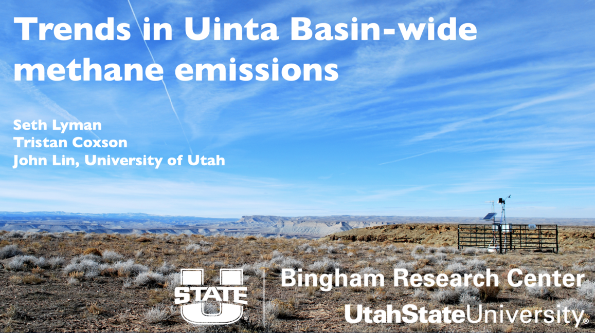
Conference: Science for Solutions
Date: March 2026
Location: Provo, Utah
NADP Scientific Symposium
Seth Lyman
Automated, dynamic, SI-traceable field calibration of atmospheric elemental oxidized mercury
View the presentation here: Perm Tube Presentation
Conference: NADP Scientific Symposium
Date: May 2026
Location: Madison, Wisconsin
American Geophysical Union's 2025 (AGU25) Annual Meeting
Seth Lyman
Oil and gas methane emissions are declining in Utah
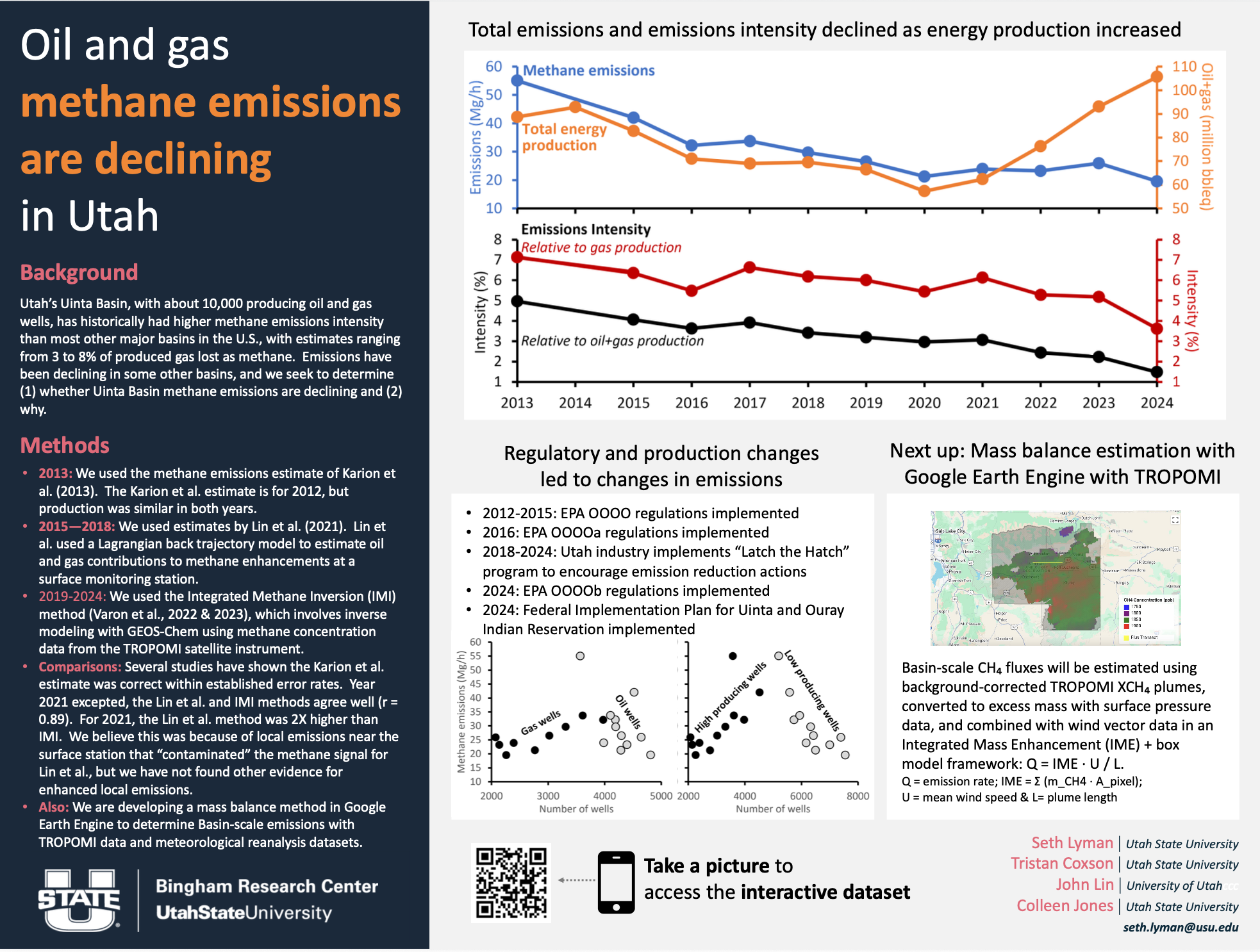
Conference: American Geophysical Union Annual Meeting
Date: December 2025
Location: New Orleans, Louisiana
Winter Ozone Update
Ozone and Weather Forecasting
Seth Lyman and John Lawson
The 2025–2026 Winter: A Clean Ozone Season
The 2025–2026 winter ended with zero days exceeding the EPA ozone standard of 70 parts per billion (ppb) at regulatory monitoring stations across the Uinta Basin. Monitors from Myton to Vernal recorded daily ozone concentrations primarily in the 30s and 40s ppb, with the season's highest reading reaching just 58 ppb at Roosevelt in late February—well below the federal standard.
This marks another welcome winter for the respiratory health of Basin residents and reflects several factors working together. Continued efforts by the oil and gas industry to improve efficiency and reduce emissions have helped lower the amount of ozone-forming pollutants released into the atmosphere. These improvements benefit both public health and the local economy by reducing product losses through leakage while maintaining compliance with air-quality regulations.
Weather also played a critical role. The lower elevations of the Basin never developed persistent snow cover, preventing the formation of the strong winter inversions (cold pools) that typically trap emissions near the surface. Snow that did fall melted quickly, likely due to extended periods of mild weather that kept ground temperatures relatively warm. Without long-lasting snow to reflect sunlight and support the chemical reactions that produce ozone, concentrations remained low throughout the season.
While these recent winters have generally been milder, it is still too early to determine whether this represents a long-term climate trend. Heavy snow events—and the high-ozone winters they can produce—remain possible, even in a warming climate. The winter of 2022–2023 serves as a recent reminder that under the right meteorological conditions, significant ozone episodes can still occur. Our research continues to examine these relationships, including using UDOT webcam imagery to better estimate snow cover across the Basin and improve ozone forecasting.
These clean winters also have important regulatory implications. In December 2024, the U.S. Environmental Protection Agency (EPA) reclassified portions of Uintah and Duchesne counties from "Marginal" to "Moderate" ozone nonattainment, a designation that would have imposed additional regulatory requirements and substantial costs on local industry. Following legal challenges from the State of Utah and the Ute Indian Tribe, and a court-ordered pause, EPA proposed in April 2026 to repeal the reclassification and instead determine that the Basin attained the federal ozone standard. Although the process is still underway, another winter meeting the ozone standard strengthens the case that air quality has improved while helping protect the Basin's economy from potentially significant compliance costs.
Improving Ozone Forecasts
The Ozone Alert program continues to provide forecasts of winter ozone risk throughout the season. Our team is currently preparing a scientific paper evaluating the performance of the Clyfar forecasting system during the 2025–2026 winter using objective statistical methods. Just as importantly, we continue to seek feedback from stakeholders on how we communicate forecast uncertainty, risk, and expected severity. Scientific evaluation, combined with community input, helps us continually improve both the accuracy of our forecasts and how we communicate them.
BasinWx Continues to Grow
Development of BasinWx remains an important part of making air quality and weather information more accessible throughout the Uinta Basin. The website is replacing the previous static monitoring site with a more modern platform providing real-time air quality observations, localized weather forecasts, and new tools designed specifically for Basin residents. Features currently under development include forecasts tailored for recreation such as boating, fishing, gardening, and aviation, including crosswind forecasts for local airports.
One of the newest additions is the road weather page, developed by undergraduate research assistant Michael Davies. The page combines real-time UDOT webcams, road conditions, and estimates of snow cover to provide additional insight into winter weather conditions that influence ozone formation.
Although staffing changes early in 2026 temporarily slowed development, progress has continued thanks to contributions from several undergraduate and high school research assistants. We hope to continue expanding these educational opportunities while further improving BasinWx as a valuable resource for the community.

Eyes in the Sky: Drones Take Aim at Methane in the Uinta Basin
By Colleen Jones
Methane is one of the most potent greenhouse gases tied to oil and gas production, and it can slip into the atmosphere at nearly every step of extraction, processing, and transport. Measuring those emissions accurately matters for regulators, operators, and anyone who cares about the air over the Uinta Basin. The trouble is that traditional ground-based methods are slow, cover limited ground, and often can't reach the remote or hazardous sites where measurements are needed most.
That's the gap the Bingham Research Center set out to close with an unlikely tool: a drone. By mounting a high-resolution methane analyzer and a 3D sonic meteorological station on an aircraft, the team can fly straight into difficult terrain, gather real-time data, and map emissions across large areas faster and at lower cost than crews on the ground ever could.
The project is a partnership between the Bingham Research Center and USU Eastern's Unmanned Aircraft Systems (UAS) Certificate Program, pairing environmental research with hands-on drone expertise. Students don't just observe; they design, build, program, and fly. The center's methane/3D sonic drone was built alongside USU Eastern students, and a rotating crew of student pilots, currently led by student drone pilot James Peterson, has been central to every phase of testing.
Recent progress has come on several fronts. On the software side, a USU Eastern student finalized the programming workflow and wrote the Standard Operating Procedures for setup, calibration, and field operations. The team ran controlled "smoke test" flights to study how propeller downwash disturbs a methane plume, a critical question for measurement accuracy, and Arjun, a new Bingham Research Center hire, took the lead on coding a real-time visualization system that maps methane concentrations in flight and renders emissions in 3D afterward.
Flying the missions by hand turned out to be just as important as the sensors themselves. Using a hexacopter, the team flew Visual Line of Sight missions in parallel transects, orbital loops, and expanding square patterns at altitudes from 20 to 50 feet above ground. Manual control let pilots adjust on the fly as plumes shifted and terrain changed. The expanding square pattern proved the clear winner for capturing methane around an emission source, offering broad coverage, repeatability, and room to scale. Those skills trace back to USU's UAS program, which drills manual proficiency on both fixed-wing and multirotor aircraft, preparing students for exactly the dynamic field conditions this project demands.
The effort has also grown through a new collaboration with Gus Williams at Brigham Young University, a partnership that has added flight time, fresh expertise, and momentum. Together with the BYU team, we've completed several joint test flights, both at USU in Vernal and out in the field, giving us more chances to refine flight patterns, stress-test the system under real conditions, and compare notes across two research groups chasing the same goal.
One of the biggest milestones was finishing the live-feed measurement app, the in-flight piece of Arjun's real-time visualization system. Rather than waiting until a flight is over to see what the sensors captured, the crew can now watch methane measurements stream in during the mission itself. Real-time feedback lets pilots adjust on the spot by repositioning the drone, re-flying a pattern, or chasing a plume while it's still in view, instead of discovering gaps in the data only after landing.
We've also kept after a stubborn technical challenge: prop wash. The same propellers that keep the drone aloft stir the air around the sensor inlet, and that turbulence can distort the very plume we're trying to measure. To get clean readings, we're testing a range of sampling methods designed to capture methane accurately while minimizing the influence of the drone's own downwash.
Next up are calibration and validation using certified gases and a mass flow controller, completion of the data-processing software that fuses GPS, weather, and chemical data into emission-flux estimates, and field deployments at active oil and gas sites in partnership with regional energy companies. The team remains on track to finish system validation and begin operational measurements within the year, putting an efficient, scalable, and affordable methane-monitoring tool into the hands of researchers and regulators alike. Let's see where this takes us.

From Cattails to Crop Dusters: Drones Help Restore Stewart Lake
By Colleen Jones
Tucked near the Green River in Uintah County, Stewart Lake is a wetland that punches above its weight, providing vital spawning and rearing habitat for two federally endangered fish: the razorback sucker and the bonytail chub. Healthy habitat depends on a balance of open water and emergent vegetation, but cattails (Typha spp.) and invaders like Canada thistle, Russian knapweed, and whitetop can take over, crowding out open water, restricting flow, and pushing out native diversity.
PhD student Lisa Boyd is tackling that challenge in her doctoral research at Utah State University with a cost-benefit analysis of cattail control, comparing controlled burns, herbicide, goat grazing, and combinations across experimental plots, and testing whether spring treatments work as well as fall ones. Tracked with satellite and drone imagery, the study has wrapped data collection and is now in analysis, headed for a dissertation chapter and a peer-reviewed paper under the mentorship of Dr. Doug Ramsey and Dr. Colleen Jones.
A companion two-year project (2024-2025) put that thinking into action with precision spray drones across roughly 100 acres of the complex. Using GPS guidance and variable nozzles, the drones deliver herbicide exactly where it's needed and almost nowhere it isn't. A multispectral prescription flight mapped the targets, and on September 27, 2025, spray drones treated 13 acres of noxious weeds, cutting total herbicide volume, curbing runoff, and improving the open-water connectivity endangered fish depend on. That same day, a field day with USU Extension and WildAss Aerial trained six participants in flight planning, imagery collection, and precision application.
Momentum is carrying into the next season. The team has just finished its third year of collecting aerial imagery, which will guide this fall's precision spraying and another public field day, with plans to scale the precision-drone framework to more wetlands across the Uintah Basin. From goats to GPS-guided sprayers, Stewart Lake is becoming a proving ground for sustainable, technology-driven wetland restoration.

Verifying How Mercury Transforms in the Atmosphere
Four-university collaboration completes its first round of environmental chamber testing
By Seth Lyman and Colleen Jones
NSF Collaborative Research: Verification of Atmospheric Mercury Redox Rates
Researchers at the Bingham Research Center and three partner universities have completed the first round of testing in a new environmental chamber, an early milestone in a four-year, NSF-funded effort to understand how mercury moves through and changes in the atmosphere. Mercury is a toxic pollutant that travels long distances before settling into ecosystems, where it can accumulate in fish and wildlife. The project aims to verify the rates of oxidation, the reactions that convert mercury into forms that deposit more readily, which remain poorly understood and limit the global models used to predict where mercury ends up.
In its first phase, the team built a large 35 m3 chamber at BYU, upgraded instruments to measure different forms of mercury, and began testing reactions under controlled conditions, with computer modeling now underway to interpret the results. The collaboration has also trained six students and presented preliminary results at conferences across the United States, with two to five peer-reviewed publications now in preparation. Next, the team will continue experiments and student mentoring across institutions, publish its findings, and present at the 17th International Conference on Mercury as a Global Pollutant (ICMGP) in Hyderabad, India, October 4-9, 2026.

Figure 1. Environmental chamber at Brigham Young University in Provo, Utah.
New Emissions Tracking Website- BasinEnergy.info
BasinEnergy.info is a new web platform designed to handle, organize, analyze, and visualize emission and energy data from the Uintah Basin. The core platform is developed in PHP using the Laravel framework.
The platform currently supports data collection from multiple sources, including online repositories such as Carbon Mapper, live-streaming field sensors installed across different parts of the Uintah Basin, and historical literature, surveys, and datasets collected over past years. These resources include emission data for gases such as CO2 and CH4, along with related environmental and energy-sector information.
BasinEnergy.info integrates these diverse datasets into a unified system that audits, processes, and presents the information in a clear and accessible format. The goal is to provide end users with a simple but meaningful overview of local emission trends, energy activity, and environmental status within the region.
The platform uses both numerical modeling and machine learning techniques to evaluate and interpret data. Numerical models range from large-scale finite element modeling (FEM) (under development) to smaller localized models. Machine learning models include predictive, classification, and trend-analysis approaches. These tools help identify patterns, estimate future conditions, and support data-driven interpretation of emission behavior.
A key feature of the platform is its end-user interface, which includes AI-assisted descriptions that summarize the overall story behind the data (under development). This allows users to better understand complex emissions and energy trends without needing advanced technical expertise. In short, BasinEnergy.info aims to serve as an analysis and visualization platform for emission monitoring, energy analysis, and environmental assessment in the Uintah Basin.

Keep in Touch
- Come by our offices at 320 N Aggie Blvd, Vernal, or contact us electronically.
- If you would like to keep up to date about what's going on with Uinta Basin air quality, consider joining the Uinta Basin Ozone Working Group.
- Find us at our booth at the Uinta Basin Energy Summit in September.